
By Eva Nmeir
Al-Bara is part of the UNESCO World Heritage site “Ancient Villages of Northern Syria”, inscribed in 2011 and since 2013 on the “List of World Heritage in Danger”. From a total of 36 individual World Heritage sites in 8 Archaeological Parks, ten are located in the area of al-Bara (Park No. 4 – “Jebel Zawiye 1”: al-Bara, Batrasa, Baʿuda, Bshalla, Dalluza, Majliya, Rabiʿa, Sirjilla, Shinshirah, Wadi Martahun).
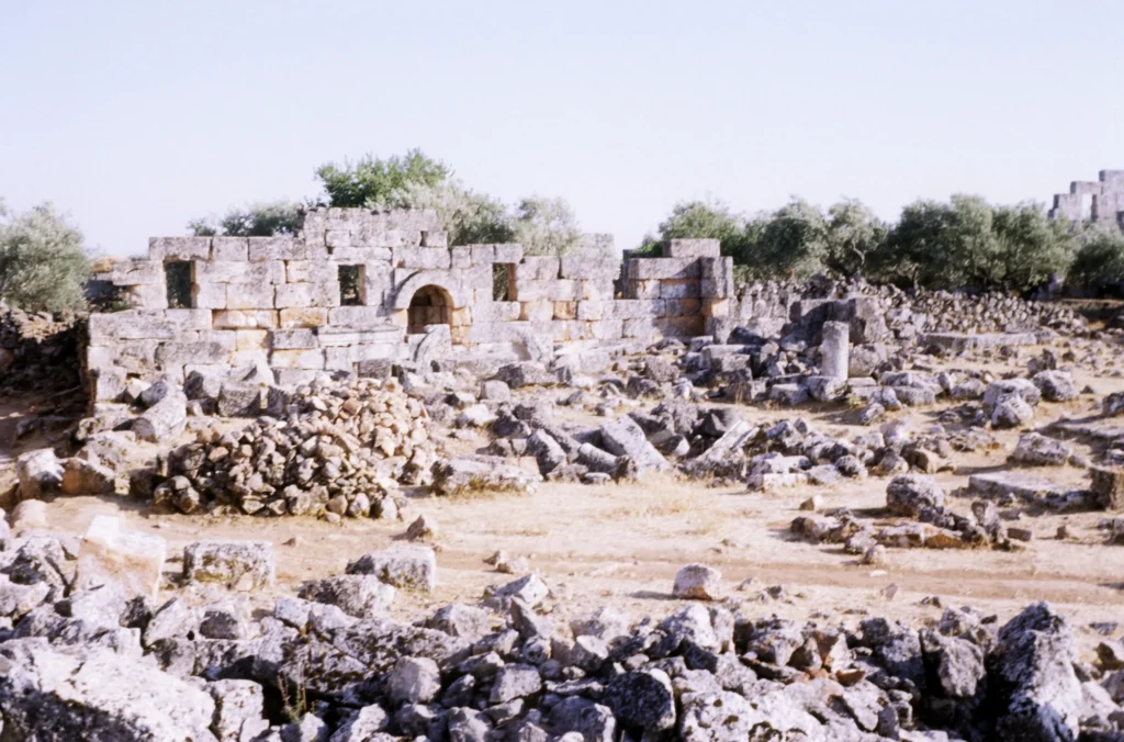
The Early Byzantine settlement of al-Bara (Kapropera) is located in the Jabal az-Zawiya, or Zawiya Mountain, at a height of ca. of 675 m. It is centrally situated in the valley corridor between the north-eastern and south-western parts of this comparatively large and high mountain range in the south of the north Syrian Limestone Massif (Idlib Governorate). The vast site stretches along the east-facing slope of the Wadi al-Juz valley opposite the small town of al-Bara, which was founded at the beginning of the 20th century (Fig. 1, 2). The ruins of the ancient settlement stand amid plantations, usually olive and fruit trees. There are mostly small plots of red soil with dry-stone walls, interspersed with rocks.
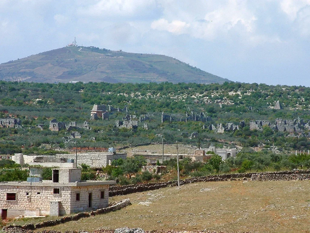
Al-Bara is the largest of the abandoned ancient settlements – the so-called Dead Cities – in the Limestone Massif (Fig. 3). It is generally assumed that more than 700 sites are still in existence today. Besides the Byzantine Dayr Samʿan (Telanissos) and Brad (Kaprobarada) as well as the Roman Maʿiz located further north in the highlands, this place is considered to be of an urban nature. During the Early Byzantine period, from the 4th century onwards, al-Bara became an important regional and, in particular, economic and religious centre of the Jabal az-Zawiya. For a long time, it was part of the administrative area of the city of Apamea (Apamene) on the edge of the adjacent Ghab Plain. It was connected to the Late Antique network of trade routes in north-west Syria that branched out between the metropolises of Apamea in the south and Antioch in the north-west as well as Aleppo in the north-east.
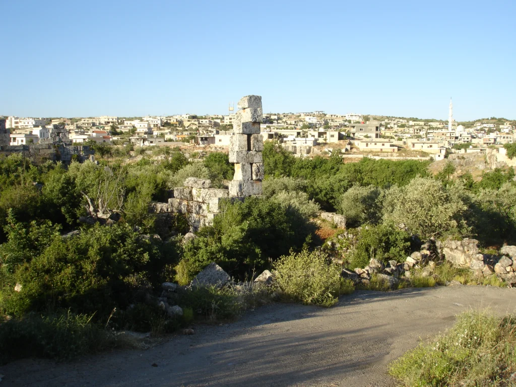
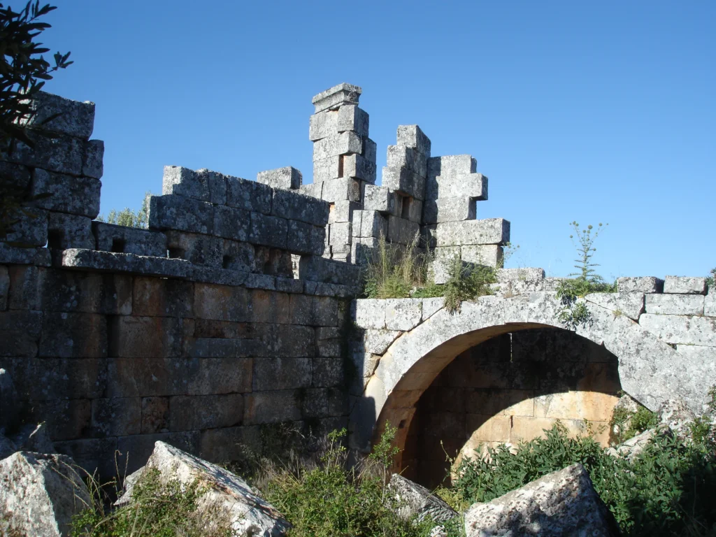
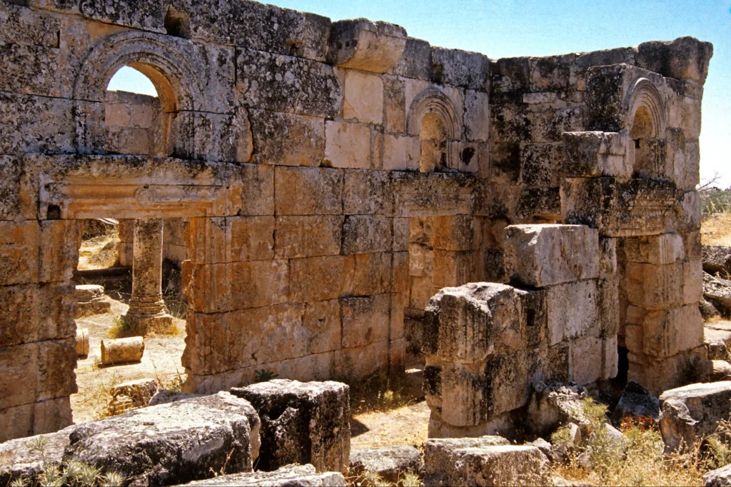
The local catchment area included a number of smaller places, for example Majliya and Batrasa, as well as some monasteries, for example Dayr Subat, which were located just outside the settlement (Fig. 5, 6). Agricultural land produced crops, especially from the cultivation of olives as well as grapes and wheat which were processed locally. As a result of the favourable topographical situation, al-Bara had a well – an exception in the water-scarce Limestone Massif, where people depended on the storage of rainwater in cisterns to a greater extent than in the lowlands.
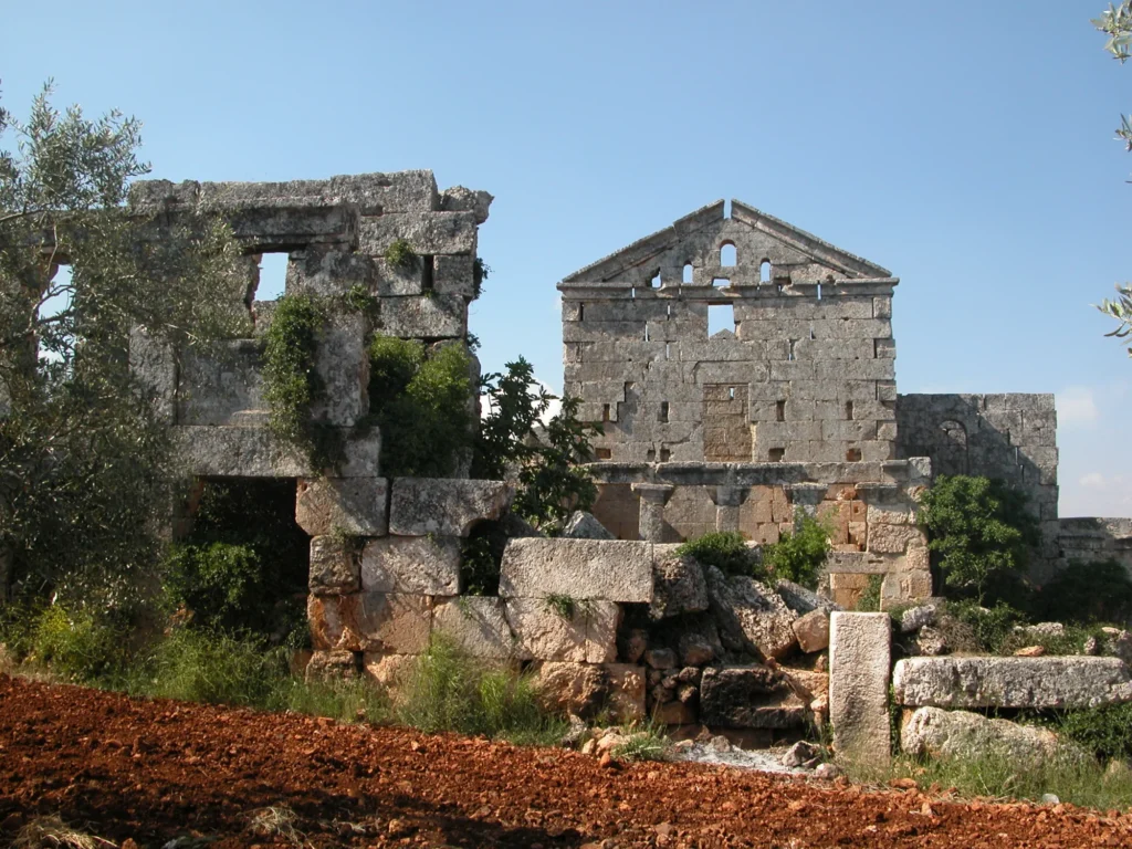
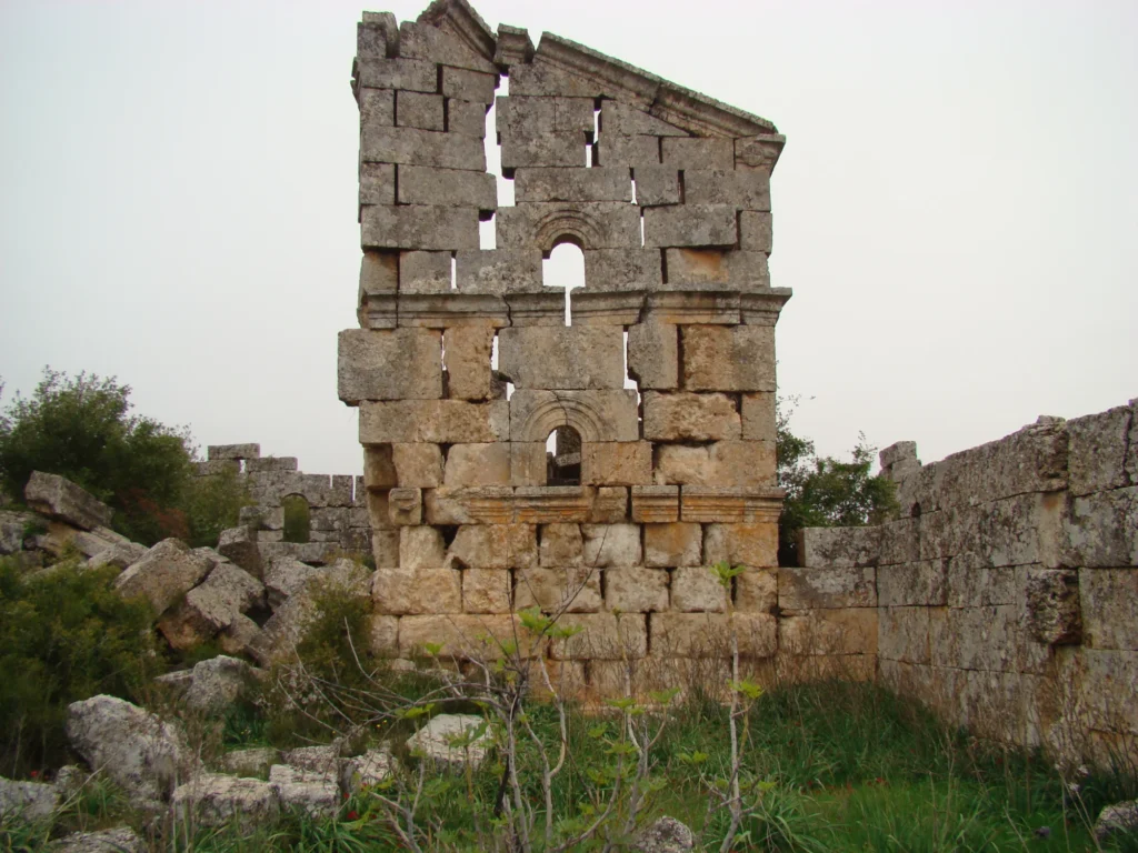
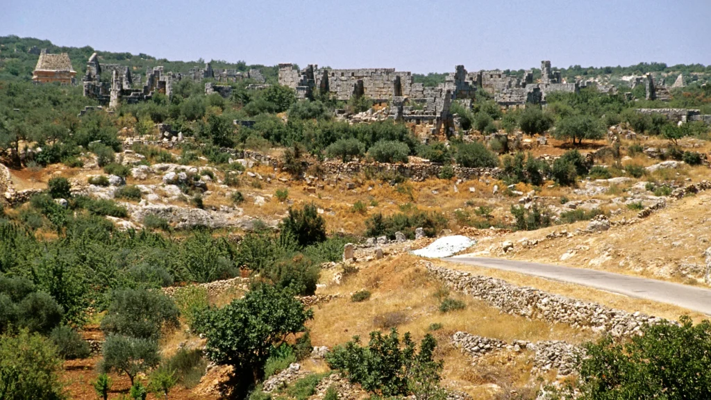
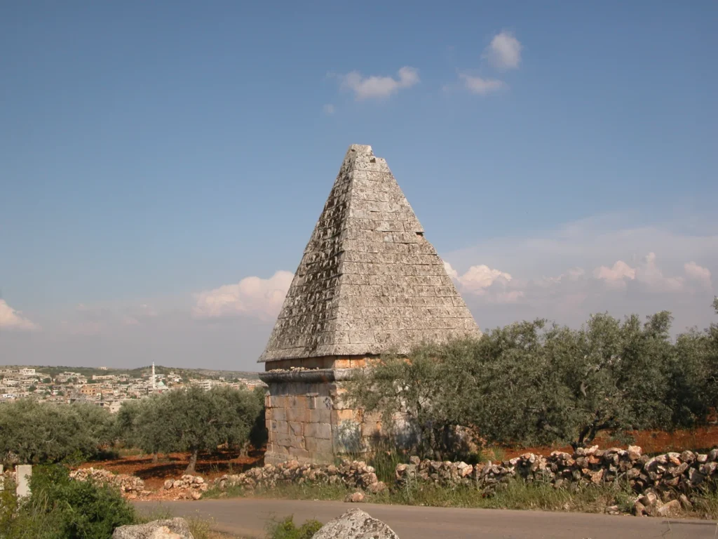
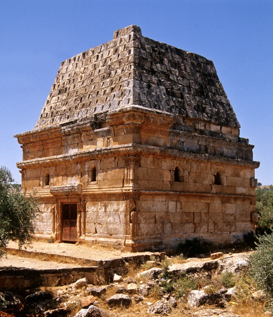
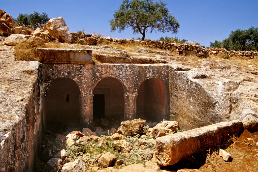
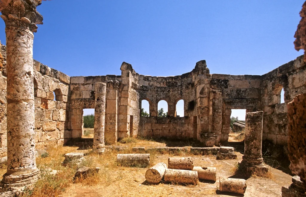
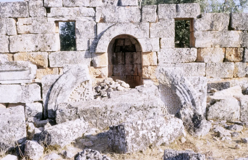
Evidence of the development of the village, the prosperity of its inhabitants and the skills of both local and non-local construction workshops can be seen in the high density and diversity of buildings erected in ashlar masonry from the local limestone: The oldest buildings are dated to the 2nd half of the 4th century. A phase of strong building activities is noted from the 5th century to the 1st half of the 6th century, especially residential buildings were intensively built until about 470. A large number of houses (featured image), five churches (Fig. 11 and 12), monasteries (Fig. 5), tombs (Fig. 4, 9 and 10), olive and wine presses (Fig. 7, 8) and other buildings date back to this period.
Al-Bara was abandoned in Islamic times towards the end of the 12th century; this had been preceded by two devastating earthquakes. Yet it existed longer than most of the settlements in the northern Syrian highlands, which had also been abandoned in Islamic times up until the 9th/10th century for several reasons. Like other ruin sites from the group of the Dead Cities, it can provide an extraordinarily authentic and vivid impression about the built environment of the people who lived there in former times. These kinds of historical insights are rare.
Many of the existing Late Antique buildings, some of which are monumental, did not experience any substantial changes since they were first constructed. Part of them has been remarkably well preserved throughout the past 1,500 years. Finally, they shed light on the development of Early Christian architecture. Other buildings have undergone adaptations to their respective functions over the various epochs, which can be easily assessed in an uninhabited settlement such as the ruins of al-Bara. Archaeological excavations by the Syrian Directorate of Antiquities (DGAM) between 2007 and 2010 in a central cluster of buildings uncovered Early Byzantine thermae and parts of a possibly Early Abbasid mosque. The thermae were converted into a hammam and eventually into a residential building in Islamic times.
The situation of the monuments is affected by increasing damage and destruction, to which different factors contribute. In general terms, these result from the intensified new settlement of the region in recent decades and the associated land consumption for road and path construction, residential and commercial buildings as well as agricultural land. Tourism and the inappropriate restoration of monuments but also their dismantling for use as building material or their looting for the illicit antiquities trade play a role in the disappearance of the built heritage.
Al-Bara was directly and at an early stage affected by the military fighting in Syria since 2011 and its devastating effects. Subsequently, vandalism and illegal excavations took place. Displaced families settled in the ruins of houses and tombs in search of a place to stay. This was accompanied by increased private residential building activities and the construction of military housing. A particularly serious intervention was the bulldozing of the al-Husn Church area to extend an olive grove (Fig. 15). In some cases, damage assessments and initial restorations of historic building fabric were carried out.

Featured image: View over the late antique ruins of a residential building towards the modern small town of al-Bara (2009) | Mazhar Ranne (CC-BY-NC-ND)
Published by Eva Nmeir: Art historian with special reference to Syria. She worked for the Syrian Heritage Archive Project and its co-projects on the World Heritage sites “Ancient City of Aleppo” and “Ancient Villages of Northern Syria”, among others.