Zurück zum Inhalt

Syrian Heritage Archive Project

  • Themen
  • Bildergalerie
  • Karte
  • Einen Beitrag leisten
  • Aleppo
  • Über uns
  • Englisch
  • Arabisch
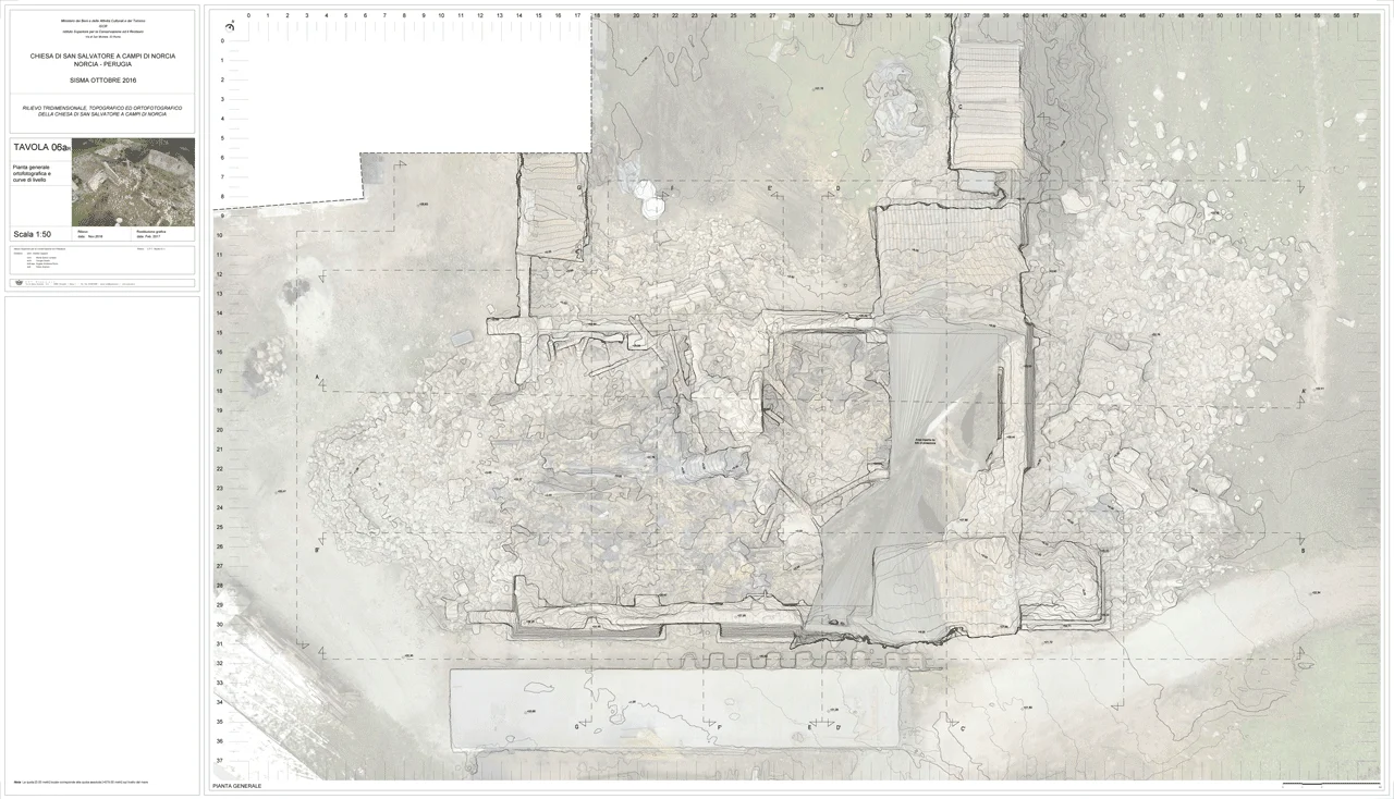
Survey of geometry of accumulated rubble, San Salvatore a Campi, Perugia, Italy

Survey of geometry of accumulated rubble, San Salvatore a Campi, Perugia, Italy

Example: extracting, in separate drawing layer, contour lines of a digital terrain model from the measurable rectified (orthophoto) drone scan/ photography of rubble remains. Three-dimensional survey of the structures in state of collapse.

Full size1280 × 734

Abb.04-b_contour lines over rectified photograph

    إZeitraum
  • 2016
    Art des Motivs
  • Denkmalpflege, Kirche, Monument (historisch), Rekonstruktion, Schaden
    Stichworte
  • Aerial photo, Assessment, Church, Schaden, Schutt
    Place hierarchy
    Author
  • C.P.T studio; Pietro Gasparri. Quelle: PDF-Datei, Seite 40: http://www.cptstudio.it/wordpress/wp-content/uploads/2012/11/CV-CPT-Studio-2021-03-en-c.pdf
    Copyright
  • 2016, einige Rechte (CC-BY-NC-SA) vorbehalten für ICR, Istituto Centrale per il Restauro (Zentrales Institut für Restaurierung) am MiBACT (Italienisches Ministerium für Kulturerbe, Ereignisse und Tourismus)Tourism)
    EasyDB ID

EIN PROJEKT VON:

GEFÖRDERT VON:

VERWALTET DURCH:

  • Datenschutzerklärung
  • Impressum
  • Cookie Richtlinien
  • Cookie Richtlinien